
Scenario · Valparaíso
Earthquake: exposure in seconds
An M 7.1 earthquake strikes offshore. Before the first damage report comes in, you already know which assets sit in the zone of highest intensity.
Situation. The USGS reports a magnitude 7.1 earthquake off Valparaíso. Ports, hospitals, substations and insured assets fall within the estimated intensity area.
What Serendyp sees. Intensity rings over the actual terrain, and every asset with its exposure, value and owner. A list of critical assets ranked by risk is ready in seconds.
What gets decided. Which facilities get inspected first, which services need backup and, for an insurer, which policies to reserve against before the first claim.
What you see
- Estimated intensity over the terrain
- Exposed insured and critical assets
- Prioritized list in seconds
- Basis for inspections and reserves
Scenario sources
USGS · estimated intensity · insured assets
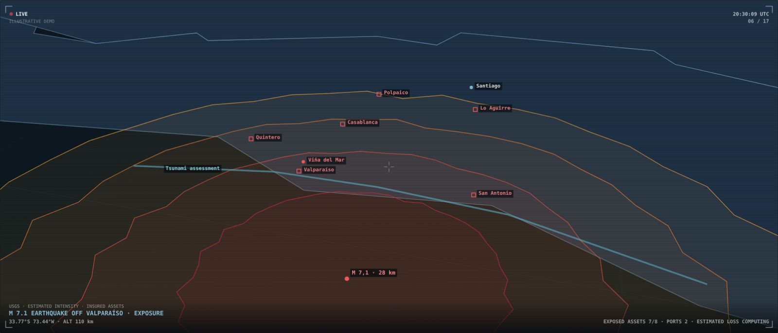
Illustrative scenario built to show the platform. It does not describe a client or a real ongoing situation.
Want to see it with your own data?
We'll show you Serendyp on your country, your sector and your risks.