
Scenario · Biobío
Wildfire and high-voltage grid
A wildfire is advancing toward a 500 kV line. The question is which towers fall first and who gets there first, more than where the fire is.
Situation. A fire near Nacimiento is spreading under a southwest wind. The 500 kV line out of Charrúa runs through the area, where ground crews, engines and a firefighting helicopter are deployed.
What Serendyp sees. The estimated perimeter is drawn from NASA FIRMS hotspots and wind. The same map shows the line's towers and every unit with its crew, status and arrival time, and the count of exposed towers updates as the perimeter moves.
What gets decided. Dispatch the unit closest to the critical section first, coordinate a preventive line shutdown with the operator in advance, and warn the municipalities downwind.
What you see
- Estimated perimeter from hotspots and wind
- Exposed towers and substations
- Units with crew, status and arrival time
- One picture for operations, management and the field
Scenario sources
NASA FIRMS · wind · georeferenced assets
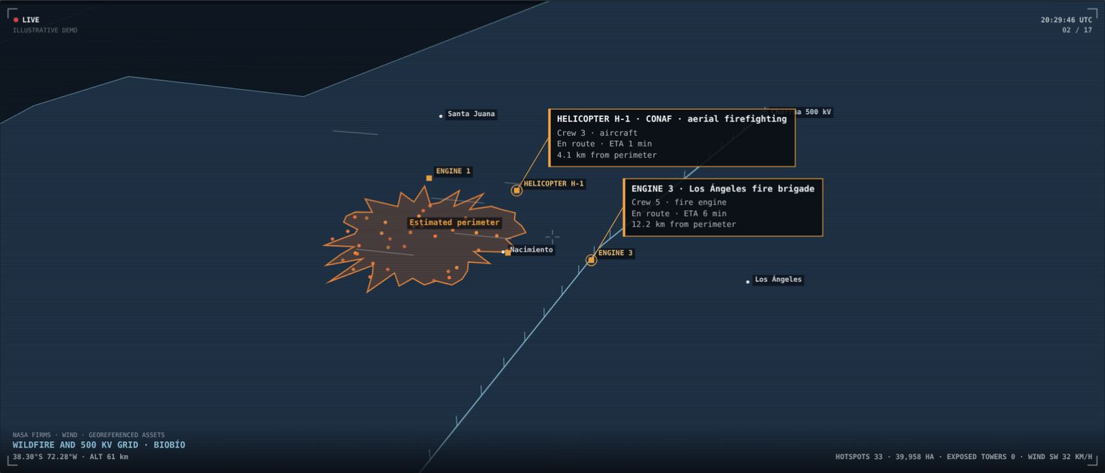
Illustrative scenario built to show the platform. It does not describe a client or a real ongoing situation.
Want to see it with your own data?
We'll show you Serendyp on your country, your sector and your risks.